Home / Products
MX Aquatic Habitat Echosounder
Product Features |
|
 |
|
DESCRIPTION
MX Aquatic Habitat Echosounder
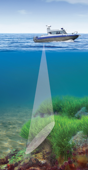
Our complete Aquatic Habitat Echosounder System lets you simultaneously acquire submerged aquatic vegetation, substrate, and bathymetry data using Visual Acquisition software and instantly create layered, colored and contoured maps using Visual Habitat software.
- Map submerged aquatic vegetation (SAV)
- Map eelgrass and other habitat areas
- Monitor invasive aquatic weeds
- Delineate areas of sand, mud, rock
- Generate contour profiles
- Shallow water mapping
Mobile survey deployment from small boats or research vessels in lakes, rivers, estuaries, shallow marine environments.
OEM version for ASVs and ROVs features a compact electronics package ideal for small, autonomous and remotely operated vehicles.
FEATURES
Echosounder Specifications
- Transmit Power: 105 Watts RMS
- Input power: 12-18 VDC or 85-264 VAC
- Draw: 5 Watts, Fuses: 1 Amp AC 1.5 Amp DC
- Transmit source level: 213 dB re 1uPa
- Pulse length: 0.4ms, Ping rate 5Hz
- Range resolution: 1.7cm
- Accuracy: 1.7cm +/- 0.2% of depth
- Depth range: 0-100m
- Operating condition: 0-50 °C
- DGPS positional accuracy: <3m, 95% typical
- DGPS velocity accuracy: 0.1 knot RMS
- DGPS update rate: 1sec
- RS232 (GPS in/out)
Dimensions
- Echosounder Unit: 37cm x 26cm x 15cm
- (14.6” x 10.2”x 6”), Wt. 5.4 kg (12lbs)
- Transducer: 8.4cm L x 4.3cm diam (3.3”x1.7”)
- 1.36 kg (3lbs), Stem threads ½” - NPS
Transducer
- Single frequency – 204.8 kHz
- Beam angle – 8.5 degree conical
- Heavy duty stainless steel housing
Data Analysis Software Features
- Visual Habitat – Fast, user friendly mapping tools
- SAV – canopy height, % cover, biomass
- Bathymetry – produce highly accurate depth charts
- Substrate classification – ID rock, sand, mud
- Export results as CSV or KML files


